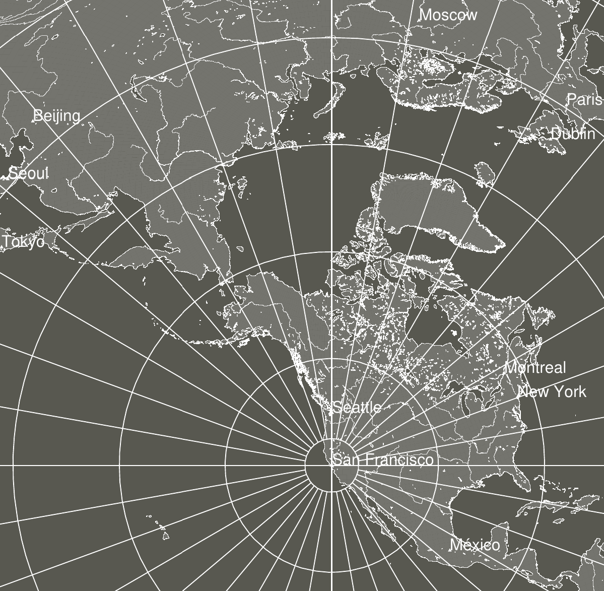
In the azimuthal equidistant projection, all points are at correct azimuth directions and proportionally correct distances and from the center of the map. A straight line between the center point and another point on the map will form a great circle path between the two locations.
Using this map with your location at center, directions to other locations on Earth correspond to directions as shown on the map. To find the angle of declination below horizontal of a straight-line path through the Earth to another location, count concentric rings out from center — the first ring is 10°, the second is 20° and so on. In the image above of a map centered on San Francisco, you can see New York is at an azimuthal heading of 70° East-northeast from the map center and a bit inside the 20° ring at ~18°. So to orient yourself towards New York while situated in San Francisco, look 70° East-northeast, then down 18° below the horizon.
Here’s a shell script I wrote for generating PDFs of these maps, along with the cities.txt file it uses to label cities:
You’ll need to install GMT on your system for the script to work. Here are some PDF maps generated with it:
San Francisco:
Letter ·
Tabloid ·
A4 ·
A3
México:
Letter ·
Tabloid ·
A4 ·
A3
Buenos Aires:
Letter ·
Tabloid ·
A4 ·
A3
Dublin:
Letter ·
Tabloid ·
A4 ·
A3
Beijing:
Letter ·
Tabloid ·
A4 ·
A3
If you’d like another location and aren’t able to get GMT set up, email your coordinates or city name along with the page size you’d like and I’ll send you a PDF map. The script is also available on Github.